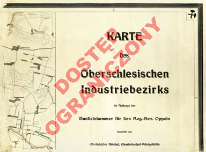
- Tytuł:
- Karte des Oberschlesischen Industriebezirks
- Współwytwórcy:
-
Handelskammer für den Regierungsbezirk Oppeln
Küntzel. Oprac. - Słowa kluczowe:
-
użytkowanie ziemi
land use
Górnośląski Okręg Przemysłowy (Polska) -- 1900-1945 -- mapy [KABA]
topographical maps
Mapy gospodarcze -- 1900-1945 [KABA]
economic maps
Mapy topograficzne -- 1900-1945 [KABA]
Upper Silesian Industrial Region
Użytkowanie gruntów -- Polska -- Górnośląski Okręg Przemysłowy -- 1900-1945 -- mapy [KABA] - Data publikacji:
- [1912]
- Wydawca:
- Phönix Verlag
- Język:
- niemiecki
- Linki:
- https://rcin.org.pl/dlibra/publication/edition/34620/content Link otwiera się w nowym oknie
- Prawa:
-
Prawa zastrzeżone - dostęp ograniczony
Rights Reserved - Restricted Access - Źródło:
-
CBGiOŚ. IGiPZ PAN, sygn. D.11749/1-20 [m.topogr.11]
http://195.187.71.2/ipac20/ipac.jsp?profile=geogpan&index=BOCLC&term=xx002700958
CBGiOŚ. IGiPZ PAN, call no.D.11749/1-20 [m.topogr.11] - Dostawca treści:
- RCIN - Repozytorium Cyfrowe Instytutów Naukowych
- Materiały ikonograficzne
Menu główne
Wyszukiwarka
Treść główna
